amman-irbid-ambil mu'ez, makan dgn
MALL- jumpa Adnin
then Ummu Qais time!!
 |
| tiang berbeza warna. hitam dinasti lain, putih dinasti lain. sebelum tu non muslim yg perintah,then slps perang, muslim menang. i think the black one is muslim dynasty. sory. lupe *_^ |
 |
| subhanallah! |
 |
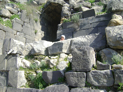
| only remnants after earthquake. large place. |
First impression when i arrived here, ehh, woww, am I at Magika shooting place??(Magika is the first fantasy film in malaysia=)
ohh,,awesome. beautiful. lovely place!!
History
The current and most widely-used name, Umm Qais, is Arabic for "Mother of Qais," a modified pronunciation and spelling of the Roman name Caius. The ancient name Gadara appears to be Semitic. It is probably derived from the Hebrew gader (גדר), meaning "fence" or "border". It is still heard in Jedūr, which is associated with the ancient rock tombs, with sarcophagi, to the east of the present ruins. These tombs are closed by carved stone doors, and are used as storehouses for grain, and also as dwellings by the inhabitants. The place is not mentioned till later times.
After Herod's death it was joined to the province of Syria (4 BC)[1]. At the beginning of the Jewish revolt in 66 AD, the country around Gadara was laid waste[2].
"So Vespasian marched to the city of Gadara. He came into it and slew all the youth, the Romans having no mercy on any age whatsoever. He set fire to the city and all the villas around it" - Josephus Wars of the Jews Book 7
The Gadarenes captured some of the boldest of the Jews, of whom several were put to death, and others imprisoned[3]. Some in the city surrendered themselves to Vespasian, who placed a garrison there[4]. The 2nd century AD Roman aqueduct to Gadara supplied drinking water through a 170 km long qanat. Its longest section running for 94 km underground, it is the longest known tunnel from ancient times to date[5]. Gadara continued to be a great and important city during Byzantine Christian times, and was long the seat of a bishop[6]. With the conquest of the Arabs, following the Battle of Yarmouk in 636, it came under Muslim rule. It was largely destroyed by an earthquake around 747 AD, and abandoned as a city.
[edit] Identification and description
Umm Qais has become a popular tourist attraction, a frequent destination for day trips from the capital, Amman, roughly 110 kilometres (68 mi) to the south. It is popular not only because of the extensive ruins but because its position on a high hill near the northwestern corner of the country allows for panoramic views. The Sea of Galilee and Tiberias, Israel, are visible, and just across the valley of the Yarmouk River is the southern end of the Golan Heights, claimed by and recognized as Syria,[7] but under Israeli administration since the Six-Day War in 1967. The high mountains bordering Lebanon are visible in the distance on clear days.
 |
| suke gambar ini! |
 |
| the road not taken? |


No comments:
Post a Comment